
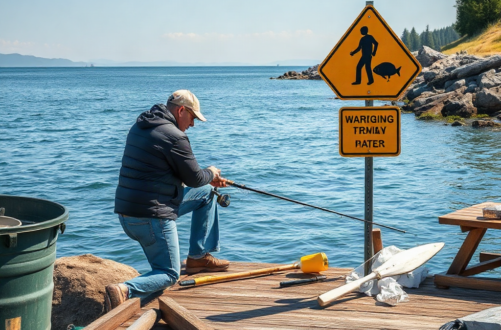
To identify and avoid dangerous areas while fishing, inspect the shoreline and water before approaching, check weather and tide conditions, and reject any position without a reliable retreat route. Warning signs include undercut banks, wet or algae-covered rocks, fast current near strainers, rising water, unstable ice, exposed ledges, and waves washing higher than expected. Observe the area for several minutes because boat wakes, surge, and changing water levels may reveal hazards that are not obvious at first glance. If footing, visibility, current, or access is uncertain, move to a safer location rather than relying on balance, experience, or emergency equipment to compensate.
Read the Water, Shoreline, and Access Route
A fishing position should be judged as a complete route, not merely as the patch of ground where you intend to cast. Examine how you will enter, stand, move while handling a fish, and leave if water rises or darkness arrives. A flat-looking bank may narrow into a steep drop behind you, while an easy descent in daylight can become difficult when wet or poorly lit.

Begin from a stable observation point and watch the area before walking down. Look for fresh erosion, cracked soil, leaning trees, loose stones, high-water debris, and sections where vegetation hangs over empty space. Undercut banks are especially deceptive because grass can hide soil that has already been removed from below. Standing close to that edge adds weight to the weakest part of the bank. Keep back from cracks and unsupported overhangs rather than testing them with a foot.
The water itself can reveal hazards beyond the bank. A smooth tongue of fast water often marks concentrated current. Boils, rotating foam, abrupt color changes, and debris repeatedly circling one spot may indicate submerged structure, an eddy, or a drop-off. Trees, root balls, bridge supports, and partially submerged brush create strainers: water can pass through, but a person may be pinned against them. A productive seam beside a fallen tree is not automatically a safe place to wade.
Consider a river angler who sees a gravel bar extending toward deeper water. At the current level, the route appears dry and convenient. If water from rain or an upstream release covers the narrow connection, however, the angler can be isolated even though the main fishing spot remains above water. Checking for secondary exits and visible high-water marks exposes that weakness before equipment is carried out.
A common mistake is treating footprints, rod holders, or discarded line as proof that a location is safe. Those signs show only that someone visited; they do not reveal the conditions, water level, or route used at the time. When applying how to identify and avoid dangerous areas while fishing, prioritize present conditions over evidence of previous use. A suitable location has stable access, room to step back, and an exit that does not depend on crossing rising water.
Recognize Current, Wave, Tide, and Weather Hazards
Moving water changes the safety of a fishing area faster than its appearance may suggest. Current gains force with depth, and water near a constriction, spillway, bridge opening, or outside bend can be much stronger than water along the adjacent shore. Cloudy water further hides sudden drop-offs, holes, discarded objects, and slick rock shelves. If the bottom cannot be seen or checked without committing body weight, staying on shore is usually the lower-risk choice.
On tidal water, the route available at arrival may not exist later. A falling tide can expose slippery mud, while a rising tide can cut off rock platforms, sandbars, and paths around headlands. Tide tables provide predicted timing and height, but wind and weather can alter observed water levels. Use local tide information as planning data rather than as a guarantee. Identify the point at which you must leave, and move before water reaches that marker.
Surf and large lakes require attention to wave patterns rather than the average wave. Sets may arrive after several quieter minutes, and reflected waves can wash across a ledge from an unexpected direction. Wet staining, attached sea growth, pooled water, and foam above the apparent waterline show where waves have recently reached. Fish well behind that boundary. Turning your back to the water while unhooking a fish or reorganizing tackle removes the opportunity to react to an incoming set.
Weather can make an acceptable area hazardous without changing its basic shape. Thunder, rapidly darkening clouds, sudden wind shifts, reduced visibility, and sharply increasing wave action are reasons to leave exposed banks, piers, beaches, and open water. Do not wait for rain to begin before responding to lightning risk. A vehicle, substantial building, or other appropriate shelter must be reachable without crossing the hazard you are trying to escape.
Dam-controlled rivers deserve separate caution. Water level and current may change because of upstream operations even when local skies are clear. Posted warnings, sirens, barriers, and access closures are operational controls, not suggestions. Never enter restricted zones below dams or assume a familiar rock remains safe at a different discharge.
The practical test is whether the water is stable enough for the entire session, not whether a cast is possible now. Conditions are failing that test when debris begins moving faster, a dry reference rock disappears, waves reach progressively higher, or the return route starts taking water. Leaving at the first sustained change preserves time to retreat without rushing.
Evaluate Banks, Rocks, Ice, and Other Footing
Footing should be evaluated for both traction and structural strength. Dry, solid ground can support deliberate movement; mud, algae, loose gravel, rotting timber, and angled rock may fail when weight shifts during a cast or when a hooked fish pulls sideways. Boots can improve grip on suitable surfaces, but no sole makes an unstable bank or collapsing shelf dependable.
Darkened rock near water often signals persistent spray or submersion. Algae can make these surfaces slick even when they do not look wet. Instead of stepping onto a questionable ledge and discovering its condition under full weight, choose a position with a wider stance area and space behind it. Three points of contact may help during a controlled climb, but climbing while carrying an assembled rod, open tackle, or a fish reduces that advantage. Pack equipment so both hands can remain available on difficult approaches.
Muddy banks present a different failure mode. The upper layer may appear firm while saturated soil underneath allows a boot to slide or sink. Steep clay banks are particularly difficult to climb after rain. If the only exit requires scrambling up the same surface, the location lacks a dependable retreat route. A longer walk to a graded bank or maintained access point is a better trade than a short descent with no safe return.
Ice demands more conservative judgment because thickness and strength vary within a single waterbody. Current, springs, vegetation, snow cover, pressure cracks, inlets, outlets, docks, and changing temperatures can produce weak areas. Appearance alone cannot establish safe ice, and following another person’s tracks does not verify current conditions. Consult local authorities or site managers, obey closures, and avoid entering when reliable local information is unavailable. Personal flotation and rescue equipment may reduce consequences in some situations, but they do not convert uncertain ice into a safe platform.
Built structures also need inspection. Damaged railings, rotten boards, missing deck sections, exposed metal, and surfaces coated with fish slime can turn a pier or dock into a fall hazard. Keep tackle, landing nets, and loose line out of walking paths. At night, use a light before each move rather than assuming the route remains clear.
The frequent mistake across all these surfaces is allowing fishing potential to override physical evidence. A visible school of fish or favorable current seam does not strengthen a bank. The safer comparison is not between that exact cast and no cast; it is between an exposed position and the next stable place that still offers workable water.

Use a Before-You-Cast Safety Decision
A repeatable check prevents urgency from controlling the decision. Anglers often become less critical after traveling a long distance, arriving late, or seeing active fish. That pressure encourages them to explain away a flooded path, worsening wind, or awkward ledge. Set rejection criteria before leaving home and apply them at the water, even when changing locations costs fishing time.
Use this compact sequence before unloading all your equipment:
- Check official conditions: Review the weather forecast, active alerts, tide predictions where applicable, access notices, and any dam or site warnings.
- Observe from safety: Watch several wave or current cycles and note waterline changes, floating debris, bank movement, and boat wakes.
- Inspect the route: Confirm stable entry, adequate standing room, and an exit that remains available if conditions deteriorate.
- Set departure triggers: Choose visible markers or conditions—such as water covering a reference rock, thunder, fading light, or loss of footing—that mean it is time to leave.
- Select the safer position: Prefer firm ground, greater setback, and a clear retreat over the cast with the shortest distance to fish.
Equipment supports this decision but cannot replace it. A properly worn personal flotation device is valuable around deep, cold, swift, or wave-exposed water. A charged phone or other suitable communication method, light, whistle, weather-appropriate clothing, and a compact first-aid kit may improve response options. Tell someone where you are going and when you expect to return, particularly in isolated areas. Communication can still fail in remote terrain, so the plan should not depend on making a call after an incident.
Fishing with a partner adds observation and assistance, but it does not justify entering a location that would be rejected alone. Agree on departure triggers and avoid both people standing on the same questionable edge. If one person slips, the other should not rush into moving water without a safe rescue method; an impulsive entry can create a second casualty.
Signs the process is working include reaching the position without scrambling, maintaining a dry retreat route, and being able to handle a fish without stepping closer to an edge. Signs it is failing include repeated slips, equipment being moved to escape encroaching water, or needing to cross a hazard to leave. Reassess after weather changes, after dark, and whenever water reaches a previously dry marker. The decision process behind how to identify and avoid dangerous areas while fishing is continuous because the safest answer at arrival may no longer be valid an hour later.
Frequently Asked Questions
What shoreline signs indicate that a fishing bank may collapse?
Cracks parallel to the edge, fresh soil falls, exposed roots, leaning trees, hollow ground, and grass overhanging an eroded face suggest instability. Stay well back and choose a supported bank.
How long should I observe a fishing spot before approaching it?
Watch long enough to see several wave, wake, or current cycles. Extend the observation when surf is irregular, boats are passing, visibility is poor, or the water level appears to be changing.
Is a personal flotation device enough for fishing near fast water?
No. A properly worn flotation device may reduce drowning risk, but it cannot prevent entrapment against strainers, impact injuries, cold-water exposure, or loss of access. Avoid the hazardous position itself.
Can footprints be used to identify a safe route to the water?
Footprints show previous travel, not present safety. Water levels, erosion, mud, ice, and weather may have changed since they were made, so inspect the entire route independently.
When should I leave a fishing area because conditions are changing?
Leave when thunder develops, visibility declines, water covers a chosen reference point, waves reach higher ground, debris accelerates, footing worsens, or the exit route begins to narrow.
Further Reading
Authoritative Sources
- National Weather Service Safety Resources
weather.govOfficial guidance covers lightning, floods, heat, cold, rip currents, and other conditions that can affect shore and boat anglers
- National Weather Service Rip Current Safety
weather.govThis resource explains how to recognize rip-current conditions and respond if caught in moving surf water
- U.S. Coast Guard Boating Safety
uscgboating.orgFederal boating-safety information helps anglers review flotation, preparation, and safe operation on navigable water
- National Park Service Water Safety
nps.govPractical water-safety guidance is useful when evaluating currents, cold water, natural shorelines, and changing outdoor conditions
Conclusion
Safe location choice depends on reading the whole setting: water movement, footing, weather exposure, access, and the route back. Inspect from stable ground, distrust unsupported banks and slick surfaces, and allow time to observe waves, wakes, tides, or changing current. Official forecasts and site notices add useful context, but conditions at the water still require direct reassessment.
Before casting, identify a firm standing area, a retreat route, and a specific trigger for leaving. Wear appropriate flotation where immersion is plausible, keep communication and lighting accessible, and avoid using equipment or experience to rationalize a weak location. If the spot requires crossing rising water, balancing near a drop, or depending on uncertain ice, choose another position. The best next step is a brief site inspection before unloading your tackle, followed by another check whenever weather, light, or water level changes.

